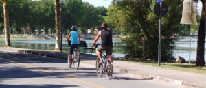
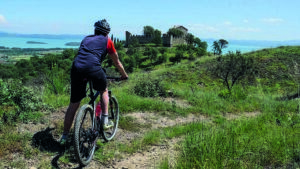
It starts from Passignano sul Trasimeno and starts pedaling towards Perugia, approaching the lake, almost touching it, at the dock for the ferries to the Maggiore and Polvese islands. Continue, alternating asphalted and dirt road until the road that goes towards Umbertide-Lisciano Niccone and Castel Rigone. Climb gently with many hairpin bends, away from traffic, and cross a hillside covered with rows of olive groves, brooms, uncultivated trees and young reforestation.
Continuing towards Umbertide, we turn towards the church of Trecine and the route becomes interesting, crossing for a long stretch the beautiful hilly ridge, characterized by continuous ups and downs, which dominates Trasimeno Lake; if you are lucky enough to walk it on a spring day, you will admire beautiful rural landscapes colored by the yellow of the broom, the purple of the cistus, the white of the heather, the green of the woods and junipers. Continue climbing to the pine forest of the word Cerro Grosso and then again along very scenic ridges to the next intersection, located shortly after Poggio Bandito.
At the height of an old farmhouse, follow the dirt track with a natural bottom leading to Mount Castiglione and then to the left to Poggio Castelluccio. We begin to descend towards the locality of Gosparini. Before arriving at the state road that connects Tuoro sul Trasimeno to Lisciano Niccone, take the old local road of the Tassinaie, currently disused and become little more than a path.
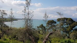
You cross stretches of wood and pastures and descend to the ditch of the Nebbie. Go up a bit and take the dirt road that leads to Fattoria Le Tassinaie, located in a suggestive landscape with a wide view of the Trasimeno Lake basin. Going down towards Vernazzano Alto, after passing the small cemetery, you can see, beyond the village, the characteristic "Torre Torta" (erected in the 11th century to defend the ancient Castle) which arouses fear due to its impressive inclination.
Continue downhill towards Vernazzano Nuovo and then, passing through the Torale area, head towards the cypress avenue of Pischiello. You can make a brief visit to the Villa, built in the mid-18th century by the Marquis Uguccione Bourbon di Sorbello, and then return to Passignano.
In short:
Starting point: Passignano (Railway Station)
Time taken: 02:50 h
Difference in altitude: 730 m
Length: 36.00 km
Degree of difficulty: difficult
Download the itinerary file to be displayed on Google Earth.