
Città della Pieve – Pobeto
ShareAverage Reviews
Descrizione
The starting point of this itinerary is located about 1 km from the Pievaiola junction, towards Monteleone d’Orvieto, at Vocabolo Casale Fargneto.
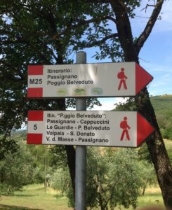
The rather wide path goes into a wood made up of very developed Turkey oaks with a rich presence of chestnut trees, sparse hornbeams and undergrowth consisting mainly of heather. Following the signs, you will skirt some more or less marked ditches along which you can see the presence of the butcher's broom and maple. You wade one for the first time and after a few meters you cross it a second time in the direction of the hill.
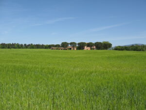
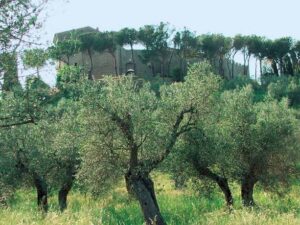
Take an uphill path leaving a more evident one on the right and make a few hairpin bends in the luxuriant wood with a prevalence of Turkey oak and after skirting an afforestation you arrive at Casale Pobeto. From here, passing between an olive grove and the wood, take the wide road until you reach a semi-ruined agricultural building.
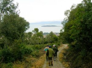
From this small promontory you can see the hills that look towards Piegaro. Return to the woods and descend to the valley floor where you can see numerous specimens of well-developed beech trees at an altitude well below the usual ones for central Italy (usually the beech is found at altitudes above 800-1000 meters) .
The wood then becomes a particularly suggestive high cerreta in the various seasons. After a first steep uphill stretch, the walk continues on a false level until it reaches a pine forest on the top of a small promontory.
Through undulating agricultural fields you return to the Provincial 71 crossing it to cover a short stretch of the itinerary that is on the part that faces towards Mount Cetona. Passing between agricultural fields and olive groves, turn right along a dirt road that leads back to the provincial road left before and then to the access road to Casale Fargneto, the starting point of the excursion. The itinerary is 7,850 km long.
In short:
- Starting point: Città della Pieve
- Time taken: 02:00 h
- Length: 7.85 km
- Degree of difficulty: medium
Download the itinerary file to be displayed on Google Earth.
Download the coordinates of the itinerary for your satellite navigator.